


Into the dark
The Corsa della Bora starts in Trieste at 19:00 on Saturday. Runners on the S1 Bora Ultra and the S1 Trieste Ultra leave the city while it is still lit and reach Val Rosandra in the dark: the Bagnoli aid station is at kilometre 13.2, and from there the course works its way up the valley on trails CAI 015, 046, 001 and 039 before coming out onto the plateau towards Basovizza.

At night you see very little: the white wall on your right, the stream below, other people’s head torches ahead. By day, this valley is where Trieste took its water, its salt and, for a few decades, its smuggled coffee.
Water for Tergeste
On the first stretch of the valley, near the Premuda hut, the piers of a Roman aqueduct are still standing. It took water from the Oppia spring, at the foot of Monte Carso, and carried it to Tergeste: some seventeen kilometres, up to 5,800 cubic metres a day, built around the 1st century AD and still in use in late antiquity.
That is why this valley counts for more than its size suggests: it was the water supply of the Roman city.
The salt road
The trail the race follows today runs for much of its length along the old salt road. Merchants from Carniola came down this way to the salt pans at Zaule and went back up towards the interior. Salt was a state monopoly, so salt was also contraband: in Slovene tradition the figure is Martin Krpan, who carried salt from Istria on his little mare — a literary character, not an archive document, but he tells you what the air was like here.
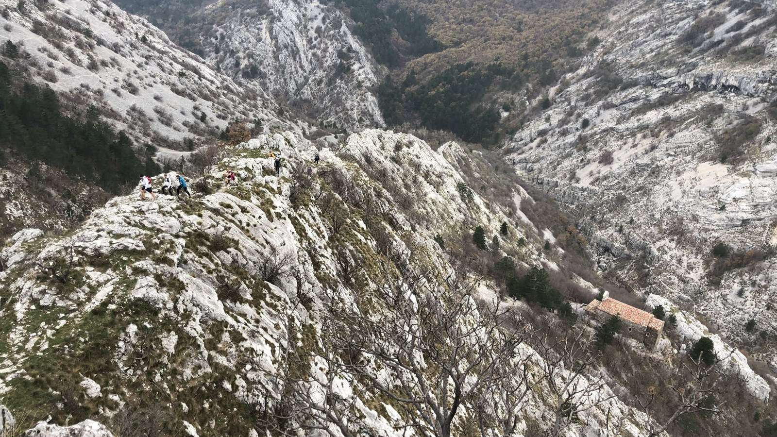
Above Bottazzo/Botač, on a rocky spur, stands the Tabor of Draga: a fortified enclosure built in the fifteenth century by local people as shelter from Ottoman raids. Bottazzo is the last group of houses before the border, and the border — the real one, with guards — ran through here until the day before yesterday.
Two inscriptions from 1819
On the flank of Monte Carso opens the Grotta delle Antiche Iscrizioni, number 966 in the regional cave register: entrance at 403 metres, thirty metres of horizontal gallery, an old resurgence the water has abandoned.
The name comes from two inscriptions carved near the entrance, one on each wall: Gemeinde Bolunz 1819 and Gemeinde Dolina 1819. They are not travellers’ signatures or mysterious symbols: they are two boundary markers written in stone, the point where the municipality of Bagnoli ended and San Dorligo began, under Austria. Two hundred years later, this is still a valley where borders get counted.
Comici’s training ground
The walls you glimpse from the trails were the training ground of Emilio Comici, one of the strongest climbers of the twentieth century, born in Trieste. The memorial stone was placed in 1941, the year after his death. Anyone who gets here at night, in the race, sees none of it: they only feel the valley closing in and the climb starting.
The name
In Slovene the valley is Dolina Glinščice, after the stream. There is no agreement about where the name comes from: one theory links it to klin, wedge — the stream wedging itself into the rock. Anyone writing that it definitely comes from glina, clay, is choosing the more convenient version.